
ACCELERATED BY CURIOISITY
Curiosity drives our continuous journey to solve the challenges of our customers.
We dare to go where no one has gone before, exploring new perspectives, new data and new technology.
At Geojunxion, we transform complex spatial information into actionable digital solutions that truly make a difference.
From smarter mobility to safer environments and more sustainable communities, our work enables organizations to make better decisions, faster.
• Empowered by data
• Focused on creating positive global impact

SMART DATA. REAL IMPACT.
We help you turn complex spatial information into clear, actionable insights.

Enhancing safety and compliance with up‑to‑date geospatial risk information

Optimizing mobility and logistics through accurate, enriched location data

Building smarter, more sustainable environments with detailed spatial insights

Automating decision‑making using powerful APIs, dashboards and integration tools
Reducing operational complexity with data you can trust, always current, always clear
TRUSTED BY





DECOS TECHNOLOGY GROUP
Decos Technology Group brings together a variety of innovative companies, each with their own deep expertise, united by a shared ambition to create smarter, simpler and more sustainable digital solutions. Our strength lies in the synergy between our people, technologies and platforms - enabling us to accelerate innovation, deliver high‑quality products and offer a seamless customer experience across our entire ecosystem. We continuously look for opportunities to grow and are always open to exploring strategic acquisitions that strengthen our portfolio, enhance our impact and expand our reach.

ECO ALERT ZONES
Accurate geospatial data on low-emission zones, vehicle access restrictions and regulated areas. Helps navigation platforms and fleet operators plan compliant routes and reduce the risk of fines and delays.
DIGITAL MAPS
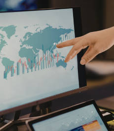
Structured digital map datasets covering road networks, geographic boundaries, addresses and points of interest. Designed for integration into navigation, routing, GIS and location-based applications.

ZIP+4
Detailed US ZIP+4 geographic boundary data that supports precise location analysis, address-based planning and delivery operations. Designed for integration into GIS, logistics and business applications.

LAST MILE MAPS
Custom mapping data for complex locations such as stadiums, campuses, theme parks and event venues. Includes internal pathways, entrances, facilities and access points to support navigation, operations and safety planning.

FERRIES
Structured ferry route data covering water crossings, ports, terminals and schedules. Supports multimodal routing and journey planning across coastal, island and inland water transport networks.
BUILT-UP AREAS
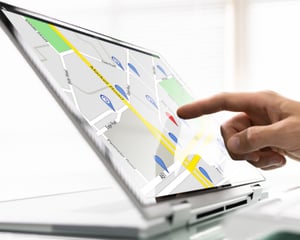
Geospatial boundary data identifying the actual footprint of cities, towns and settlements. Supports urban planning, infrastructure development, geographic analysis and location-based decision-making.

GEOACCESS
A geospatial calculation service that standardizes road-distance, travel-time and commute-related calculations. Helps organizations apply consistent rules across reimbursement, mobility, logistics and enterprise systems.

TILE SERVER
Scalable map tile rendering and hosting infrastructure for enterprise mapping applications. Provides greater control over map delivery, customization and performance while reducing dependence on third-party mapping services.